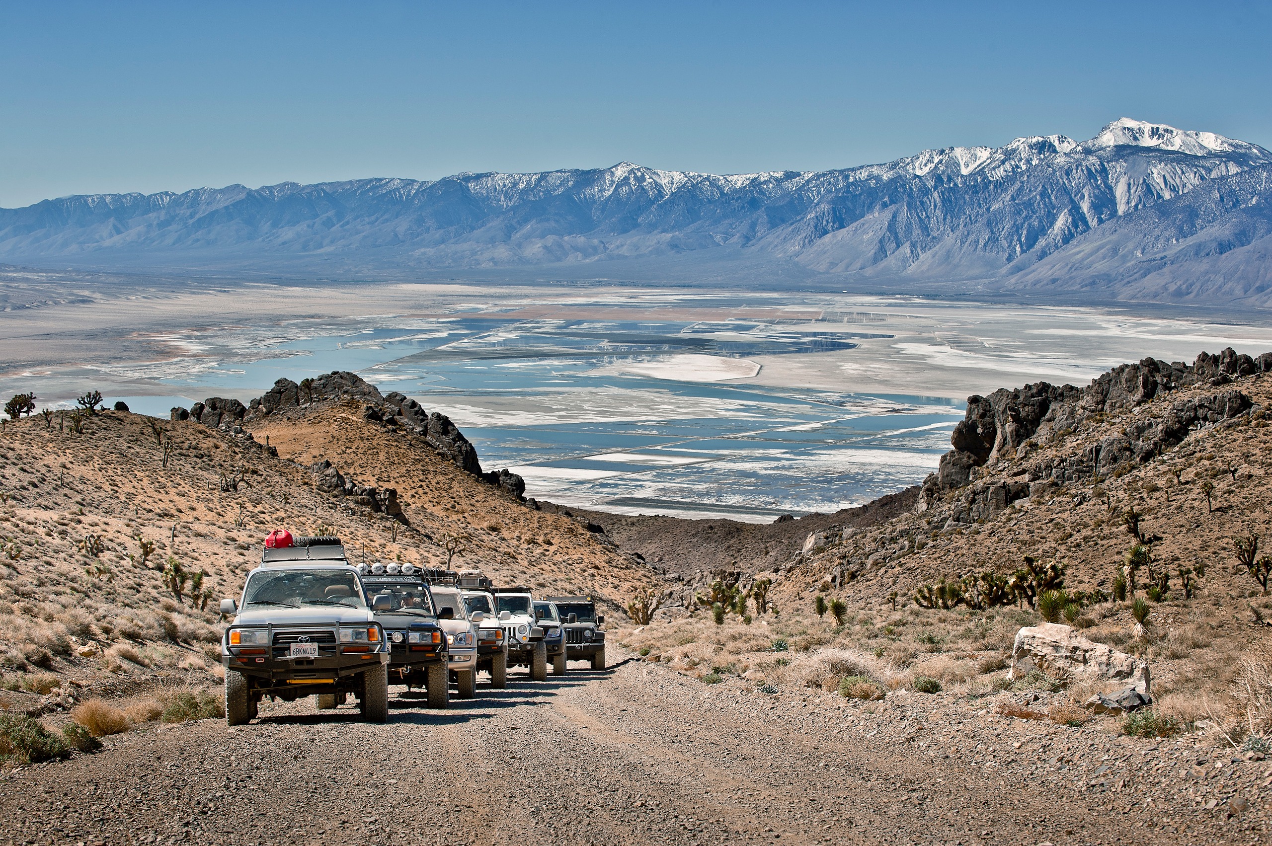
Get ready for adventure! Overland Bound One Expedition Mode allows you to take your adventure further with essential expedition features necessary for travel off grid.
Expedition Mode requires an annual subscription and is available in iOS and Android.
Expedition Mode includes:
Offline Mode – Use maps and navigate offline
Offline Maps – Download maps for use without cell connection
Track Recording – Record your off road route and telemetry
Save Offline – Save location POI and Tracks while offline
Download and Share GPX – Download or share any GPX track
Upload GPX - Upload any GPX file for use in the app
Offline 3 Word Navigation – Search and share 3 word locations offline
Let’s review the features and how to use them in the Overland Bound One app.
Let’s go!
Full Video tutorial available here.


Offline Mode

Traveling off-grid requires the ability to access information, save data and navigate with and without cell service or internet connection. Overland Bound One Expedition Mode has you covered for this both manually and automatically. You can make this selection in advance of your trip.
1. Offline Mode - Manual
1. Select “Settings” in the apps slide out menu.
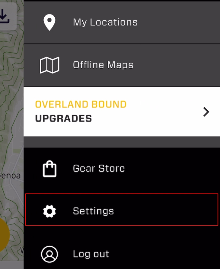
2. Select “Offline Mode” to turn it off or on at any time.
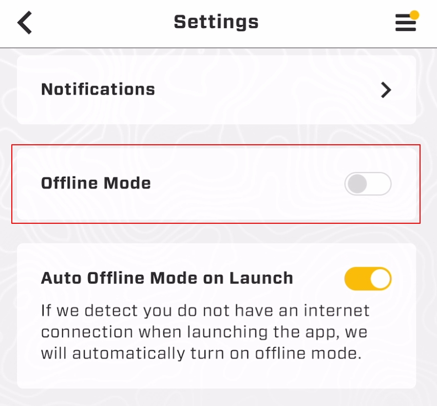
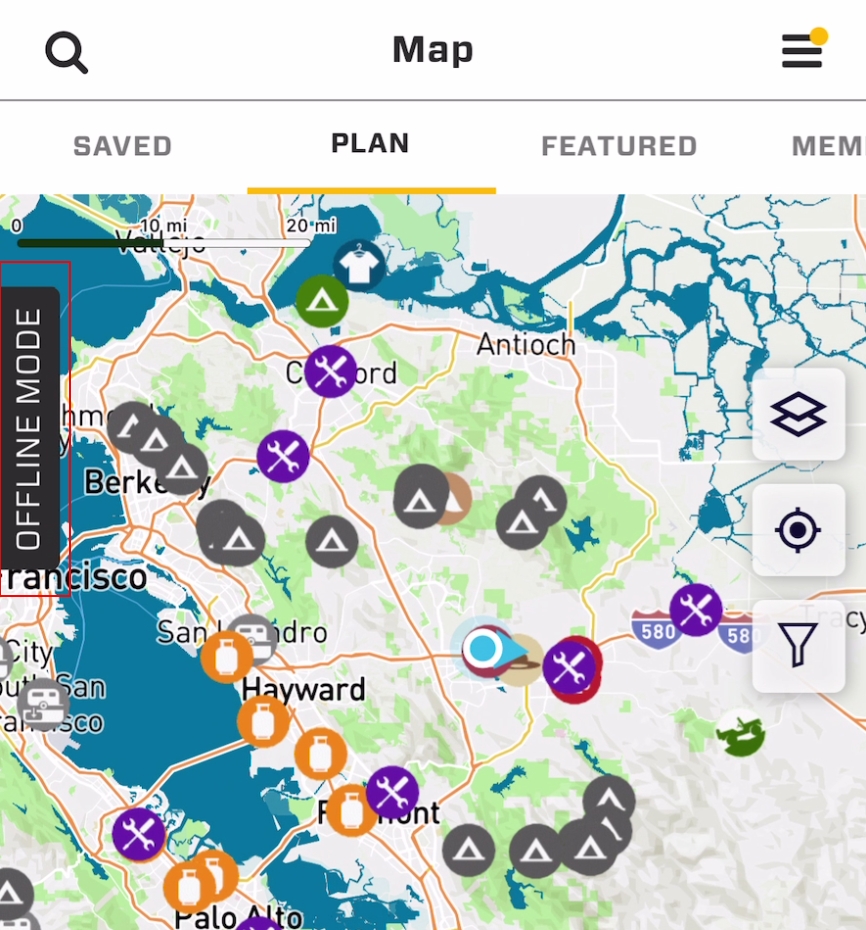
A banner will appear on the map to remind you you are in Offline Mode. This mode will prevent the app from trying to connect, and will disable features that require cell service or internet connection. This allows you to use the map and navigate with a GPS signal built into your phone or tablet.
2. Offline Mode - Automatic
Automatic mode will put the app into Offline Mode if it is launched when there is no cell service or internet connection. It will also turn off Offline Mode if it is launched with cell reception.
To turn Automatic mode on, do so in settings:
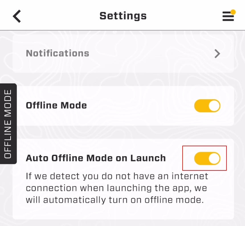
Note: Auto Offline Mode will not dynamically go in and out of offline mode while in the app. If you are in offline mode and your phone or iPad connects to cellular data during your travels, it will not switch out of offline mode. Changes from offline to online mode while the app is running must be done manually.


Download Maps
In order to access maps and navigate without cellular or internet connection, you will need to download them in advance. Overland Bound One makes it easy by allowing you to download a wide range of map details from three places within the app:
The Main Map
A Rally Point Event location screen
Off Road Trail with GPX file detail screen
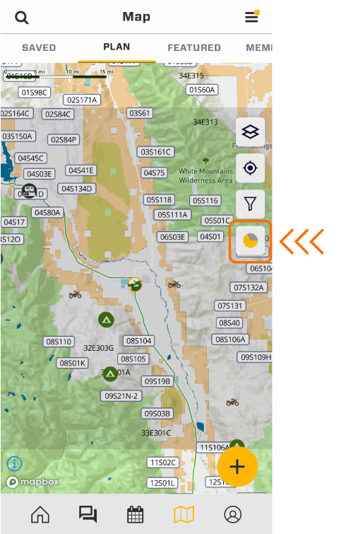
1. Download from the Main Map
Center the map screen on the area you wish to download. The download button is on the right side of the screen.
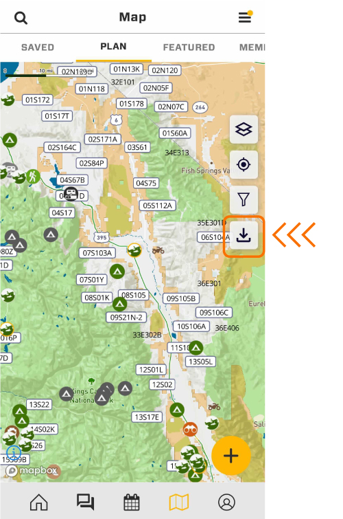
Once you tap the download button, a grey square sized 50 miles X 50 miles will automatically appear to indicate the download area.
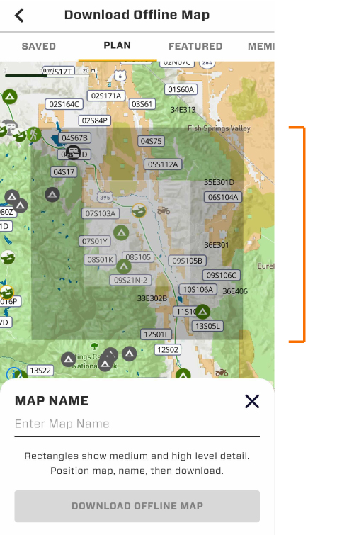
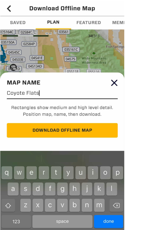
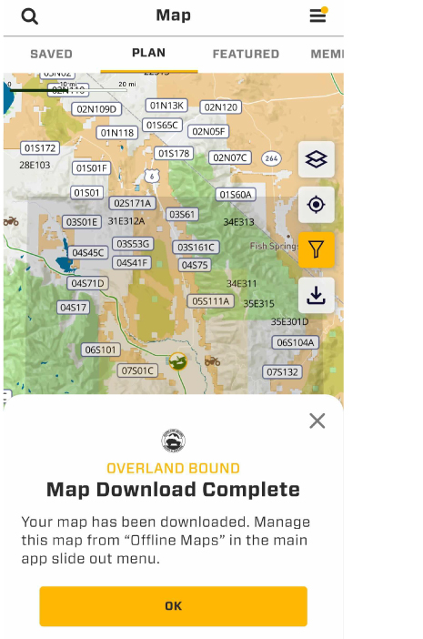
Type in a name for your map and select the “Download Offline Map” button to begin the download.
The 'download' icon will change to a circle that indicates the download progress.
You will receive a confirmation once the download is complete.
All details and information available while online will now be available for offline use. This includes topographic details, roads and highways and trails.
To access your saved maps, go to the slide out menu and select "Offline Maps".
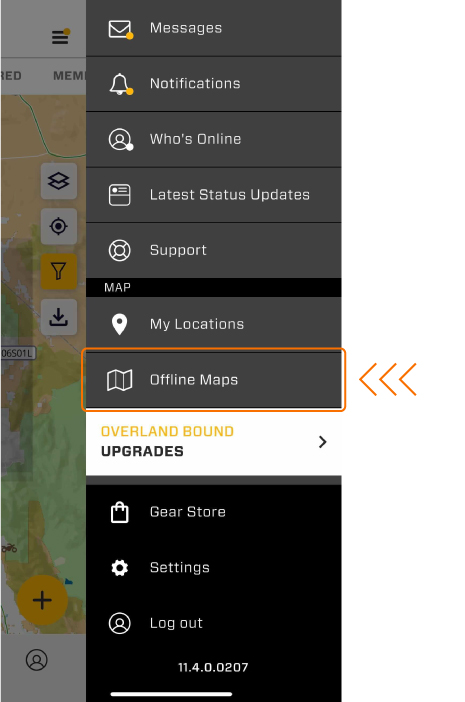
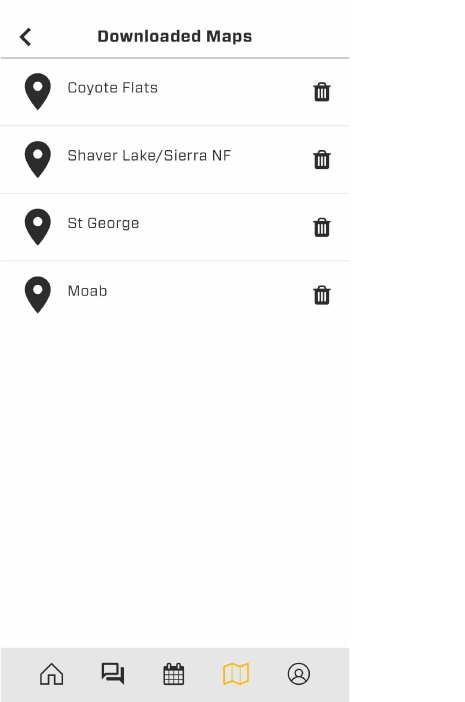
All downloaded maps will be listed here for future use.
PRO TIP: Preparing for a trip or planning to venture into a new region? Add "Download Offline Map" to your pack out and prep check list.


Off Road Track Recording
Expedition travelers often go beyond the paved roads. Record your route to save for later, share with your friends, or just to find your way back! Track recording is easy in Overland Bound One, and records high resolution tracks accurate to 1 meter with telemetry information.
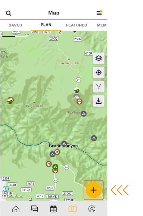
To record a track, go to the Map screen and select the “+” at the lower right of the map screen.
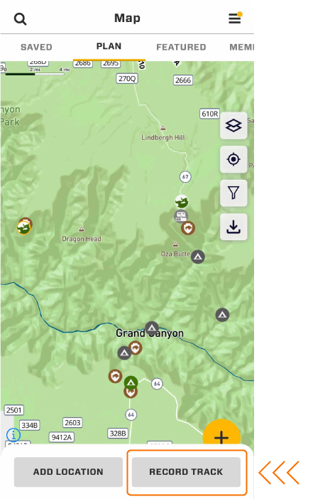
As soon as you select “Record Track”, the recording will begin and the record interface will appear.
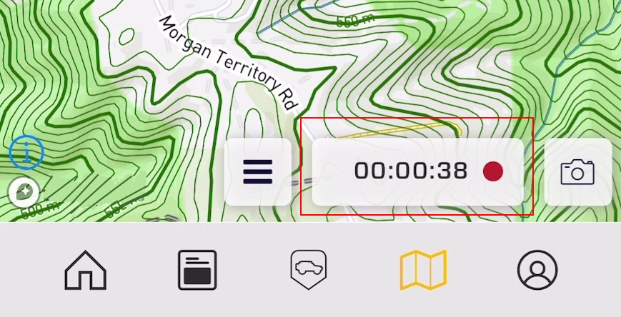
There are three buttons, the stacked menu (1), the record duration button (2), and the photo button (3).
1. Stacked Menu
The stacked menu provides three functions:
Pause Recording – Pause the recording process. Re-enable to begin recording again.
Save Track – Stop recording and add track details, then save
Cancel Recording – Stop recording and return to the map without saving
You can close the menu and return to the map with no change.
2. Record Duration Button
Selecting the record duration button will do the following:
The recording details screen will open. This screen is meant to be open while driving to relay important navigation details if required.
Details include:
Current Speed
Heading
Speed profile
Elevation profile
Distance travelled
Duration
Current location
Pace
3. Photo Button
The photo button on the main map will create a thumbnail image for the recorded track while recording. This image will be visible in the track summary card and the details screen.


Save Tracks and POI Offline
You can save your POI and recorded tracks even if you are offline. You will see notifications informing you of your offline status. Once you reconnect with cellular reception or internet, a confirmation will appear once your locations are uploaded. This upload will happen automatically.
Why upload your locations? There are two primary reasons:
1. Location Backup
Your locations are saved regardless of the device you use to access the Overland Bound platform. You can even delete the app and install it at a later date. Your communications and your locations will exist just as you left them. Your locations will never be lost.
2. Sharing
You can save your locations as either private or public. If you save them as a public location, other members will see the location to help them on their journey. (Thanks in advance for that!)